Facts, data, and accountability. You give us the address and date of loss — we map it out for you. Use our free search tool to find your date.
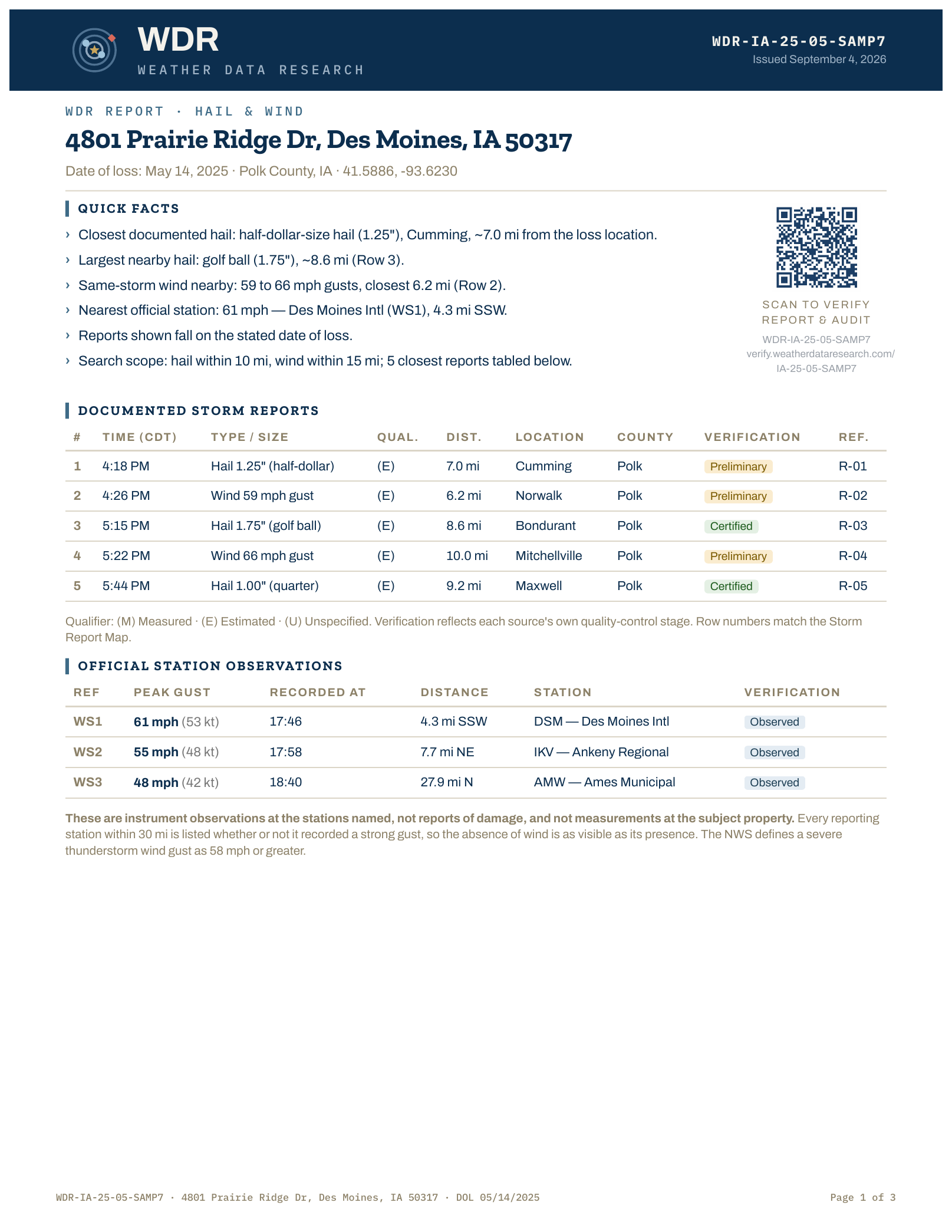 See the full sample →
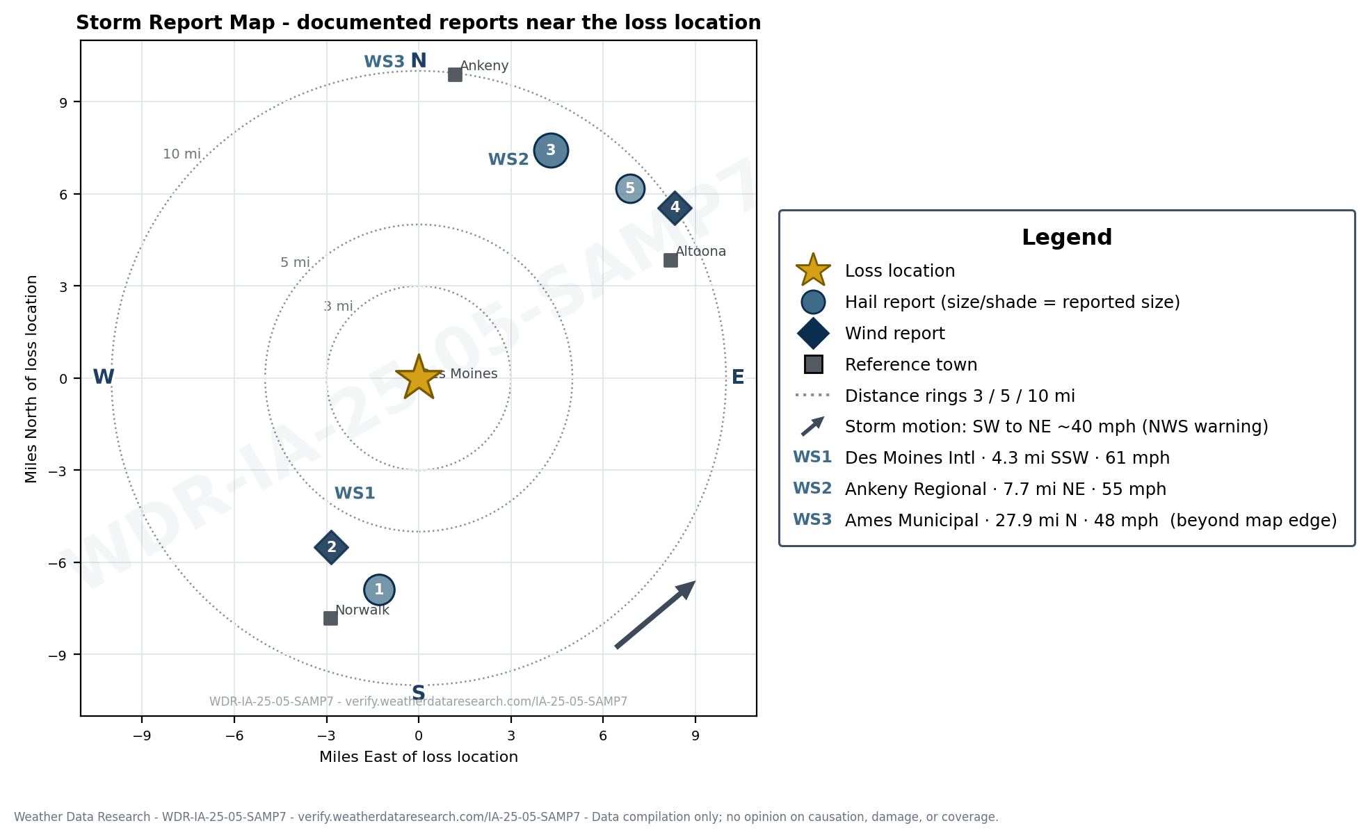
Sample WDR Report map. Made-up property — no real address or claim.
Verification and authenticity? Scan the QR code to view an authentic original copy of the report and an audit report. With real data, there is nowhere to hide.
 Click here for Audit Report Sample
Same made-up property as the map above.
| # | Time (CDT) | Type / Size | Qual. | Dist. | Location | County | Verification | Ref. |
|---|---|---|---|---|---|---|---|---|
| 1 | 4:18 PM | Hail 1.25" (half-dollar) | E | 7.0 mi | Cumming | Polk | Preliminary | R-01 |
| 2 | 4:26 PM | Wind 59 mph gust | E | 6.2 mi | Norwalk | Polk | Preliminary | R-02 |
| 3 | 5:15 PM | Hail 1.75" (golf ball) | E | 8.6 mi | Bondurant | Polk | Certified | R-03 |
| 4 | 5:22 PM | Wind 66 mph gust | E | 10.0 mi | Mitchellville | Polk | Preliminary | R-04 |
| 5 | 5:44 PM | Hail 1.00" (quarter) | E | 9.2 mi | Maxwell | Polk | Certified | R-05 |
Qualifier: (M) Measured · (E) Estimated · (U) Unspecified. Verification reflects each source’s own quality-control stage — never our opinion of it. Row numbers match the map.
Don’t know the date of loss?
Search the official storm record for the property and see every date hail or wind was documented nearby — the last year, two years, or five. Free, and always will be. No card, no account.
You get a list of dates with the number of hail and wind reports on each, the largest hail size, the peak gust, and how close the nearest report was. Pick a date and order the full report from there.
Want every date on one sheet for the claim file? Add the Storm Date Record Report — Free, credited back if you order a report for any of those dates. Every date in it links straight back to order.
Find my date of loss — free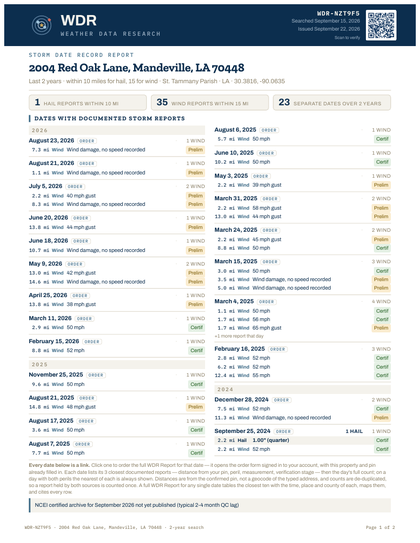 See a sample →
Being clear about the boundary is part of the product. A report that overstates what it is gives the other side something to pull on.